5
views
0
recommends
+1 Recommend
0 collections
    0
    shares
      • Record: found
      • Abstract: found
      • Article: found
      Is Open Access

      UAV Based Spatiotemporal Analysis of the 2019–2020 New South Wales Bushfires

      , , , ,
      Sustainability
      MDPI AG

      Read this article at

      Bookmark
          There is no author summary for this article yet. Authors can add summaries to their articles on ScienceOpen to make them more accessible to a non-specialist audience.

          Abstract

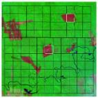
          Bushfires have been a key concern for countries such as Australia for a long time. These must be mitigated to eradicate the associated harmful effects on the climate and to have a sustainable and healthy environment for wildlife. The current study investigates the 2019–2020 bushfires in New South Wales (NSW) Australia. The bush fires are mapped using Geographical Information Systems (GIS) and remote sensing, the hotpots are monitored, and damage is assessed. Further, an Unmanned Aerial Vehicles (UAV)-based bushfire mitigation framework is presented where the bushfires can be mapped and monitored instantly using UAV swarms. For the GIS and remote sensing, datasets of the Australian Bureau of Meteorology and VIIRS fire data products are used, whereas the paths of UAVs are optimized using the Particle Swarm Optimization (PSO) algorithm. The mapping results of 2019–2020 NSW bushfires show that 50% of the national parks of NSW were impacted by the fires, resulting in damage to 2.5 million hectares of land. The fires are highly clustered towards the north and southeastern cities of NSW and its border region with Victoria. The hotspots are in the Deua, Kosciu Sako, Wollemi, and Yengo National Parks. The current study is the first step towards addressing a key issue of bushfire disasters, in the Australian context, that can be adopted by its Rural Fire Service (RFS), before the next fire season, to instantly map, assess, and subsequently mitigate the bushfire disasters. This will help move towards a smart and sustainable environment.

          Related collections

          Most cited references49

          • Record: found
          • Abstract: found
          • Article: not found
          Is Open Access

          Global fire emissions estimates during 1997–2016

          Climate, land use, and other anthropogenic and natural drivers have the potential to influence fire dynamics in many regions. To develop a mechanistic understanding of the changing role of these drivers and their impact on atmospheric composition, long-term fire records are needed that fuse information from different satellite and in situ data streams. Here we describe the fourth version of the Global Fire Emissions Database (GFED) and quantify global fire emissions patterns during 1997–2016. The modeling system, based on the Carnegie–Ames–Stanford Approach (CASA) biogeochemical model, has several modifications from the previous version and uses higher quality input datasets. Significant upgrades include (1) new burned area estimates with contributions from small fires, (2) a revised fuel consumption parameterization optimized using field observations, (3) modifications that improve the representation of fuel consumption in frequently burning landscapes, and (4) fire severity estimates that better represent continental differences in burning processes across boreal regions of North America and Eurasia. The new version has a higher spatial resolution (0.25°) and uses a different set of emission factors that separately resolves trace gas and aerosol emissions from temperate and boreal forest ecosystems. Global mean carbon emissions using the burned area dataset with small fires (GFED4s) were 2.2  ×  10 15  grams of carbon per year (Pg C yr −1 ) during 1997–2016, with a maximum in 1997 (3.0 Pg C yr −1 ) and minimum in 2013 (1.8 Pg C yr −1 ). These estimates were 11 % higher than our previous estimates (GFED3) during 1997–2011, when the two datasets overlapped. This net increase was the result of a substantial increase in burned area (37 %), mostly due to the inclusion of small fires, and a modest decrease in mean fuel consumption (−19 %) to better match estimates from field studies, primarily in savannas and grasslands. For trace gas and aerosol emissions, differences between GFED4s and GFED3 were often larger due to the use of revised emission factors. If small fire burned area was excluded (GFED4 without the s for small fires), average emissions were 1.5 Pg C yr −1 . The addition of small fires had the largest impact on emissions in temperate North America, Central America, Europe, and temperate Asia. This small fire layer carries substantial uncertainties; improving these estimates will require use of new burned area products derived from high-resolution satellite imagery. Our revised dataset provides an internally consistent set of burned area and emissions that may contribute to a better understanding of multi-decadal changes in fire dynamics and their impact on the Earth system. GFED data are available from http://www.globalfiredata.org .
            Bookmark
            • Record: found
            • Abstract: not found
            • Article: not found

            Local Spatial Autocorrelation Statistics: Distributional Issues and an Application

              Bookmark
              • Record: found
              • Abstract: found
              • Article: found
              Is Open Access

              The collection 6 MODIS active fire detection algorithm and fire products

              The two Moderate Resolution Imaging Spectroradiometer (MODIS) instruments, on-board NASA’s Terra and Aqua satellites, have provided more than a decade of global fire data. Here we describe improvements made to the fire detection algorithm and swath-level product that were implemented as part of the Collection 6 land-product reprocessing, which commenced in May 2015. The updated algorithm is intended to address limitations observed with the previous Collection 5 fire product, notably the occurrence of false alarms caused by small forest clearings, and the omission of large fires obscured by thick smoke. Processing was also expanded to oceans and other large water bodies to facilitate monitoring of offshore gas flaring. Additionally, fire radiative power (FRP) is now retrieved using a radiance-based approach, generally decreasing FRP for all but the comparatively small fraction of high intensity fire pixels. We performed a Stage-3 validation of the Collection 5 and Collection 6 Terra MODIS fire products using reference fire maps derived from more than 2500 high-resolution Advanced Spaceborne Thermal Emission and Reflection Radiometer (ASTER) images. Our results indicated targeted improvements in the performance of the Collection 6 active fire detection algorithm compared to Collection 5, with reduced omission errors over large fires, and reduced false alarm rates in tropical ecosystems. Overall, the MOD14 Collection 6 daytime global commission error was 1.2%, compared to 2.4% in Collection 5. Regionally, the probability of detection for Collection 6 exhibited a ~3% absolute increase in Boreal North America and Boreal Asia compared to Collection 5, a ~1% absolute increase in Equatorial Asia and Central Asia, a ~1% absolute decrease in South America above the Equator, and little or no change in the remaining regions considered. Not unexpectedly, the observed variability in the probability of detection was strongly driven by regional differences in fire size. Overall, there was a net improvement in Collection 6 algorithm performance globally.
                Bookmark

                Author and article information

                Contributors
                (View ORCID Profile)
                (View ORCID Profile)
                (View ORCID Profile)
                (View ORCID Profile)
                Journal
                SUSTDE
                Sustainability
                Sustainability
                MDPI AG
                2071-1050
                September 2021
                September 13 2021
                : 13
                : 18
                : 10207
                Article
                10.3390/su131810207
                2812245d-bb52-4288-991b-087b1253445d
                © 2021

                https://creativecommons.org/licenses/by/4.0/

                History

                Comments

                Comment on this article