- Record: found
- Abstract: found
- Article: not found
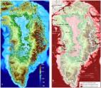
Greenland Ice Sheet Daily Surface Melt Flux Observed From Space
Read this article at

Abstract
Greenland Ice Sheet (GrIS) surface melt has contributed to the global sea‐level rise and the ongoing warming is expected to promote this process. This study provides a new strategy for the quantitative estimate of GrIS daily surface melt at enhanced resolution (3.125 km) from a remote sensing perspective beyond traditional regional climate models (RCMs). Daily melt flux is estimated from spaceborne radiometer observations with a back‐propagation neural network model. The network is trained with melt fluxes that are calculated using detailed in‐situ atmospheric and snow observations and a surface energy balance model. Our results provide details about the extreme melt in mid‐July 2012 when surface melt occurred at Summit and the meltwater volume exceeded 20 Gt as a result of anomalous warming. Meltwater volume from the satellite is very close to that from RCMs.
Plain Language Summary
Spaceborne observations have been widely used to detect ice sheet surface freeze‐thaw status. This study further provides a way to quantitatively estimate Greenland Ice Sheet (GrIS) daily surface melt flux with an enhanced resolution of 3.125 km based on observations from microwave radiometers and automatic weather stations. Results from the satellite suggest the GrIS melted extensively in summer with a peak that occurred on 11 July 2012 when 22.42 Gt meltwater was produced as a consequence of anomalous warm air. Annual meltwater volume from the satellite is very close to that from regional climate models (RCMs), with an annual mean of ∼700 Gt. Local discrepancies are mainly attributed to the misidentification of residual meltwater as active melt from satellite observations and the inappropriate parameterization of snow processes in RCMs. Though the satellite‐based melt retrieval model still shows poor representation in regions where in‐situ observations are sparse, it provides an alternative way to estimate GrIS daily melt flux from a remote sensing perspective beyond RCMs.
Key Points
-
Daily surface melt flux of the Greenland Ice Sheet (GrIS) is estimated at enhanced resolution (3.125 km) from a remote sensing perspective
-
Daily meltwater volume exceeded 20 Gt in mid‐July 2012 as a result of anomalous warming
-
Meltwater volume from satellite agrees well with that from regional climate models
Related collections
Most cited references66
- Record: found
- Abstract: not found
- Article: not found