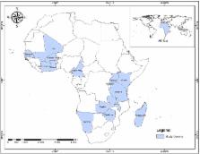
Introduction Remarkable gains have been made in the provision of drinking-water supply and sanitation (WSS) globally, with over 2 billion people reportedly gaining access to improved drinking-water sources and 1.8 billion to improved sanitation between 1990 and 2010 [1]. The WHO and UNICEF's Joint Monitoring Programme for Water Supply and Sanitation (JMP) has reported that the world is “on track” to reach the Millennium Development Goal (MDG) target for water supply of reducing by half the proportion of the population without access to sustainable and safe water [1]. In spite of such global gains, important national and sub-national inequalities in WSS coverage remain, including significant rural-urban and regional disparities [1],[2]. National studies also highlight systematic inequalities in WSS access, typically focusing on rural-urban or socio-economic disparities and coverage in hard to reach groups [3]–[9]. Access to safe water and sanitation facilities is a fundamental human right. Unimproved drinking water and sanitation are responsible for an estimated 1% of global disability-adjusted life years (DALYs) [10], and 85% of diarrhoea mortality can be attributed to inadequate water, sanitation, and hygiene practices (WaSH) [11]. Populations with inadequate WSS are also disproportionately affected by the neglected tropical diseases (NTDs) [12]–[17], and as such WSS are increasingly recognised as critical for sustaining the impact of control and elimination strategies that rely on geographically targeted mass drug administration [18],[19]. There have however been few published analyses of sub-national geographical distribution of WSS at policy relevant scales. To better understand inequality within and between countries, and provide a bench mark for tracking progress and help prioritize resource allocation, there is a clear need to develop policy-relevant data on sub-national inequality and a standardised approach to mapping sub-national coverage in WSS. Population-based national household cluster-sample surveys, such as demographic and health surveys (DHS) and multiple indicator cluster surveys (MICS), provide a wealth of information on the coverage of health and development indicators, including WSS, within countries and have been used previously to map geographical variation in bed net coverage [20], anaemia [21], and under-nutrition [22]. There is an important trade-off however between accuracy and spatial resolution that must be resolved before these data can be truly useful for stakeholders. Surveys are usually powered to provide accurate data for provinces or regions, although access to WSS is likely to vary markedly at this spatial scale. Modern statistical approaches, including small area estimation (SAE) and Bayesian spatial conditional autoregressive (CAR) models, can help tackle the problem of providing feasible estimates for smaller geographical areas, whilst explicitly acknowledging uncertainty associated with data powered to be representative at larger spatial scales [23]–[27]. In this paper we combine multiple national surveys using spatial statistical methods to investigate differences in use of improved drinking water, improved sanitation, and open defecation at small spatial scales; identify specific geographical areas where coverage is substantially worse than national averages; and explore relative geographic inequalities within countries. Our analysis focuses on sub-Saharan Africa (SSA), as this is the region where progression towards the MDGs for water and sanitation is often least successful [1],[28]. Our intent is not to replace existing national JMP estimates, but instead to develop robust maps of contemporary WSS coverage at a finer spatial resolution useful for service delivery providers, policy makers and those planning investment within governments, implementers, and donors. The work is conducted within the context of the Global Atlas of Helminth Infections project (www.thiswormyworld.org), which aims to develop a suite of geographical resources and tools for NTD control. Methods Data Sources WSS data were sourced from national household cluster-sample surveys undertaken as part of multiple indicator cluster surveys (MICS) (http://www.childinfo.org/mics4_surveys.html; implementation supported by UNICEF), Demographic and Health Surveys (DHS) and national malaria and AIDS indicator surveys (MIS/AIS) (http://www.measuredhs.com/data/available-datasets.cfm; USAID) and living standard measurement studies (LSMS) (http://iresearch.worldbank.org/lsms/lsmssurveyFinder.htm; World Bank). These surveys are based on probability sampling using existing sampling frames (primarily population censuses) and are conducted by trained enumerators conducting household visits, typically achieving household response rates >97%. Informed consent is obtained from all respondents before participating. All available DHS, MICs, and LSMS surveys conducted in SSA since 1990 that contained the necessary modules to calculate household WSS use were included (n = 138 surveys) [29]. Access to improved drinking water and sanitation were defined using the criteria outlined by the JMP, and are measured by reported use. For MDG monitoring, improved sanitation facilities are defined as those that “hygienically separate human excreta from human contact,” whilst improved (“safe”) drinking-water sources are defined as those that are “protected from outside contamination (especially faecal contamination).” The proportion of households reporting open defecation was also recorded. In the subset of data where distance to water source was available (n = 121 surveys), we also recorded the proportion of households using an accessible, improved drinking water source. This was defined as one within 1 km (or 15 minutes) of the household, which has been suggested as an appropriate distance for meeting the MDG targets [30]. Further details of indicator definition, and comparison with those used by the JMP, are provided in Box 1. Box 1. Comparison with the Joint Monitoring Programme Methodology Data availability Available data sources included in this analysis (DHS, MICs, and LSMS) make up 42% percent of all data in the JMP database for the same countries. Data available to the JMP that could not be used in this analysis include national surveys implemented by governments and census data. Common definitions Improved sources of drinking water: piped water into the dwelling; piped water to yard/plot/compound; public tap or standpipe; tubewell or borewell; protected dug well; protected spring; rainwater. Improved sanitation: flush toilet; piper sewer system; septic tank; ventilated improved pit latrine (VIP); pit latrine with slab; composting toilet. Open defecation: No facilities or bush or field. Not used by JMP. Accessible, improved drinking water source: an improved drinking water source (see above) within either 1 km or 15 minutes from the household. Data available in 85% of surveys. Shared sanitation facilities Contrasting variable definition: JMP classify all shared facilities as unimproved, and make assumptions on the proportion shared when this data are not available. In our main analysis, we do not distinguish between shared and private sanitation facilities as this information is only available for 70% of included surveys, although a sub-analysis is performed to compare differences Implications: Coverage of improved sanitation in countries with large numbers of households reporting shared facilities will be considerably higher than current JMP estimates Unimproved pit latrines Contrasting variable definition: older DHS surveys (phase 4 and earlier, pre-2003) do not distinguish the type of pit latrine (improved or unimproved), and for these surveys JMP make assumptions on the proportion that can be classified as improved. In our analysis all such latrines were included as unimproved to avoid misclassification. Implications: In our analysis past coverage may have been underestimated for countries with older DHS surveys, and temporal gains in coverage overestimated. Methodology JMP methods: for each country, separate linear time trends are fit through national (rural and urban) coverage estimates from survey and census data. Regression slopes are extrapolated two years outside available data; beyond this slope is assumed to be zero for a maximum of six years after which estimates are not made. Population averaging (to determine rural, urban, and overall coverage rates) relies on reported survey weights. Spatial multilevel methods: data from all countries are treated as a continuous time series and fit within a single multilevel model. This considers the hierarchical structure of the whole dataset: surveys sites are nested within administrative areas, within countries. The model estimates an average intercept and an average slope with residual variances across countries, whilst accounting for sub-national spatial correlation and non-spatial variation. In practice, this means that when there is reliable information for a specific country, predictions will closely follow the country survey points, whereas when there is little temporal (or sub-nationally disaggregated) information trends will tend to follow the regional (or national) mean. Population averaging uses high resolution population data generated by the WorldPop project [33],[34]. For each of the available surveys, the proportion of households reporting use of an improved drinking water source, improved sanitation, and open defecation were calculated at the cluster (survey site) level. Each survey site was then coded as either urban or rural as defined by the survey and was allocated, where possible, to sub-national administrative areas. For reference, in most SSA countries first administrative areas (admin1, often referred to as provinces, regions, or states) represent on average approximately 1.35 million people and are typically further subdivided into three to 15 second administrative areas (admin2, often referred to as districts, representing approximately 200,000 people). Admin1 and admin2 digital boundaries were derived for each country using the United Nations Second Administrative Level Boundaries dataset project (SALB) ([31]): for 74 surveys, survey sites were linked to admin2 using the provided survey site co-ordinates, whilst admin1 and admin2 names were used to match survey site locations for the remaining 64 surveys. For 45 of these, survey sites could be matched to admin1 only as admin2 names were not available. In these instances, survey site data were attributed to all admin2 contained within the admin1 boundaries, and weighted to reflect the number of admin2 this represented. No survey data were available for Botswana and Eritrea, and these countries (representing 0.85% of the population of SSA) are therefore not included in the analysis. Digital gridded population surfaces and urban/peri-urban extent maps for 2012 at 100 m2 resolution were provided by the WorldPop project [32],[33]. These population surfaces were used in combination with the admin2 boundaries to extract total admin2 populations and the proportion of each admin2 population living in urban/peri-urban and rural areas. As a confirmation step, the overall proportion urban generated for each country for 2012 was compared with estimates produced by the UN Urbanization Prospects [34] suggesting good agreement (r = 0.72, p 0.2). When considering rural and urban populations separately however, there was some evidence that countries with higher levels of relative inequality for use of an improved drinking-water source (i.e., positive RGI scores) also experienced higher levels of inequality for use of improved sanitation (shown in Figure 8; rural populations r = 0.47, p = 0.002; urban populations r = 0.39, p = 0.01). 10.1371/journal.pmed.1001626.g008 Figure 8 Relationship between relative geographical inequality for use of improved drinking water and RGI for use of improved sanitation for (A) rural populations (correlation (r) = 0.47, p = 0.002) and (B) urban populations (r = 0.39, p = 0.01). Discussion It is already known that coverage of WSS varies considerably between countries in SSA [1]. To our knowledge, this is the first attempt to systematically map and analyse geographical inequalities in WSS within countries. We selected three widely reported WSS coverage indicators (access to improved drinking water, access to improved sanitation, and open defecation) and have generated a new resource for researchers and country stakeholders. Our robust analytical approaches, which explore geographical heterogeneity and geographic inequalities, showed consistent findings for all the three indicators that have important implications not only for the WSS sector, but also the international public health and development communities, policy makers, and donors. In October 2013, key sector stakeholders issued a joint statement calling on the international community to ensure that the post-2015 development agenda be framed around the principle of equality, emphasising that future goals, targets, and indicators must rely on disaggregated data to allow inequalities to be effectively measured [42]. Our results suggest that there are substantial geographical inequalities in use of WSS across SSA that surpass simple urban-rural disparities and are of similar magnitude to the large socio-economic inequalities highlighted in a number of national studies [2]–[8],[12],[43]–[45]. In almost all countries, rural households in lowest coverage admin2 were 1.5 to 8 times less likely to access improved drinking water, 2 to 18 times less likely to access improved sanitation, and 2 to 80 times more likely to defecate in the open than rural households with the best access. Even across urban populations, coverage in use of improved drinking water varies on average by 30% nationally, use of improved sanitation by 5%, and dependence upon open defecation by 26% nationally, emphasising how population growth and rapid urbanisation may frequently outstrip service provision in poorer urban areas [46]. Considerable overlap in those admin2 with significantly worse coverage than the national average for both improved drinking water and improved sanitation suggests that vulnerable and marginalized populations often suffer the compounded effects of unsafe water and poor sanitation. Perhaps our most striking finding, however, is that high geographical inequality (i.e., higher than would be expected given absolute national coverage) was seen across all levels of national coverage, although for improved sanitation this was typically greater than would be expected for those countries with lowest national coverage. In addition, those countries with high levels of relative inequality in improved drinking water also experienced higher levels of relative inequality in use of improved sanitation. This finding suggests that countries struggling to increase coverage often also struggle with issues of poor targeting of resources, or patchy implementation of government or NGO delivered interventions, and need to develop strategies and investment plans with reduction of inequalities in mind. Notably, evidence from across the public health and development arena suggests that, unless governments and stakeholders deliberately adopt strategies aimed at reaching lowest coverage areas and population groups, it is unlikely that countries will achieve universal coverage [43],[47]–[49]. It is likely that areas without access to improved water supply and basic sanitation are not only the poorest, but most challenging in terms of environmental conditions and demand for resilient infrastructure, such as low or inconsistent rainfall, poor soils and deep water tables, and a paucity of available markets and materials. The publication in 2012 of the first quantitative aquifer storage maps for the African continent reveals that most countries have the potential for sufficient well-placed hand-pumps to support rural populations; however, the potential for higher yielding boreholes (required to support rapid urbanisation) is limited and will require careful planning [50]. We hope that the information presented here, when combined with quantitative mapping of groundwater resources at sub-national levels, can provide a useful tool to accurately target WSS investments geographically to those admin2 where they are most needed. These data also demonstrate the promise of using geographically disaggregated data as a complementary tool to stratifying on the basis of socio-economic status [51] when systematically measuring progress in reducing inequalities within low coverage countries. It is commonly recognised that there is no ideal measure for expressing the magnitude of inequalities [37],[52],[53], and as such we have presented both absolute (within country ranges and quintiles) and relative measures. Despite an increasing focus on spatial analysis within health research, there are relatively few publications concerning measurement methods for geographic inequality in health outcomes [54]–[57], and very few papers have explored the use of absolute or relative metrics for sub-national coverage data such as this [58],[59]. We have developed an RGI score, an adaptation of the GINI coefficient. This widely applied coefficient is a ratio analysis measure, and is independent of scale and population size, making it helpful for comparing diverse countries and groups within countries, such as urban and rural populations. It also takes full account of the entire distribution, rather than simply comparing those at the extremes. However, it is a relative measure, and as such countries with vastly differing national coverage can share the same score if the relative distribution is similar. Its use is also limited with bounded variables, such as coverage. Generating an RGI however, which compares the observed GINI coefficient with that expected given existing levels of coverage, helps circumvent the negative correlation that is to be expected when generating GINI coefficients using bounded indicators and allows identification of countries with large relative inequality in provision of WSS. Metrics such as these that accurately align with development principles, including equality of access, are urgently needed. However we would like to add a note of caution: measures of inequality should not be used in isolation, but rather in combination with indicators of absolute coverage. Importantly, equality of use does not reflect how much overall coverage has been achieved, which means that a country could achieve significantly low levels of relative inequality whilst still having very low overall coverage, as clearly demonstrated by Sierra Leone and Ethiopia. Crucially, our results are entirely dependent upon the quality of the water and sanitation data available. DHS, MICs, and LSMS surveys contain a standardised water and sanitation module in which survey questions and response categories are fully harmonised [29], helping to ensure internal consistency and comparability between countries. However, the only available proxy for sustainable access to improved drinking water source and sanitation is self-reported use and ownership. These reports are rarely if ever supplemented by visual inspection to confirm the functionality and whereabouts of the water source, or correct use of the latrine. Whilst many epidemiological studies rely on self-report to measure type and use of such facilities, to our knowledge, very few studies have examined the reliability of self-reported water and sanitation practices and few have used objective measures to assess actual use [60]. Our analysis is based on those indicators currently recommended for monitoring the MDG targets, but these indicators are subject to considerable debate [61]. For example, not all water sources that are classified as improved will provide water that is safe to drink [62]. Correction with data on drinking water quality would likely have a large impact on estimates, calling into question whether the MDG water target would actually be met by 2015 [61]. For example, the only nationally representative water quality data that exists for SSA, to our knowledge, suggests that only 72% of improved drinking-water sources in Ethiopia were in compliance with WHO and national guidelines on drinking water quality [63]. There is currently massive lack of capacity in many countries to generate reliable and representative information on drinking water quality [64], and so we are unable to make appropriate corrections. Neither have we been able to account for the reliability of water supplies—studies across SSA have suggested that up to around one-third of hand-pumps may be non-functioning—nor of household treatment of water [65]. Our preliminary analysis of distance to water source however has suggested that only a little over half of all rural households reported as using an improved water source were using one within 30-minutes round trip of their household. This is especially striking given that a recent systematic review and meta-analysis has suggested significant increase in illness risk in people living further away from their water source [66]. Distance is an important determinant of the quantity of water brought to the household and used for drinking, cooking, and hygiene behaviours [65], and given our results we would suggest that future monitoring activities should always attempt to quantify the time taken for households to obtain their water. Similarly controversial is the definition of improved sanitation. For example, a latrine that is correctly used by all members of the household and well maintained can provide an effective barrier to the transmission of faecal-oral disease, whereas a latrine that is not used correctly or that is poorly maintained can actually become a focus for the transmission of disease. Our reported use measures that rely upon the potentially subjective definition of an “improved” pit latrine. Again to avoid approximation, we only include latrines classified as having a slab as improved, which is supported by evidence from Tanzania suggesting the presence of helminth eggs in a large majority (71%) of soil samples collected from more simple pit latrines [67]. Nevertheless, it is not possible to correct for the appropriate use and cleanliness of all latrines classified as improved. Finally, as detailed in Box 1, we have classified all sanitation facilities that use improved technology as improved, regardless of whether they are shared, primarily to avoid approximating when data were unavailable (e.g., all pre-2004 surveys). Although this will include some public sanitation facilities (which may often be used by too many people, be poorly maintained, expensive or distant, and even post a risk for interpersonal violence [68]–[70]), in most instances these represent private facilities shared between five households or fewer. There is little evidence surrounding the health impacts of such facilities [71],[72], but it has been argued that a high proportion are probably safe for health [73]. This will however mean that our estimates of coverage for improved sanitation will be substantially higher than those produced by the JMP, who define all shared facilities as unimproved, preventing them from being directly comparable. The multilevel modelling approach used here is transparent and flexible, offering advantages over the traditional country-specific linear regression models currently employed by the JMP. As demonstrated in a recent similar exploration of multilevel modelling for estimating national access to drinking water and sanitation [46], using a single model for all countries provides a continuous time series, providing additional information for those countries with scarce data. Our spatial Bayesian approach also enables use of information from neighbouring areas to improve predictions in unsampled areas [24], and quantifies the uncertainty resulting from modelling sub-national estimates at small spatial scales. Some limitations should be noted: we still relied on fitting linear time trends whereas a more flexible curve fitting approach might be more appropriate [46]; we did not include further covariates in the model; we did not consider uncertainties associated with the survey estimates arising from non-sampling errors; and we modelled household, not population, use (i.e., for each survey site we modelled the proportion of households reporting use). The latter may systematically bias our estimates upwards, as it is likely that individuals living in smaller (and potentially richer) households with greater access to WSS will be overrepresented. It will also be important to validate this work as new data become available. Although not intended to reproduce the JMP, and not directly comparable for improved sanitation, in most instances our estimates are in keeping with official estimates (improved drinking water: r = 0.77, root mean squared error [rmse] 11.3%; open defecation: r = 0.92, rmse = 7.7%) although they do differ substantially for individual countries, up to 33% for access to an improved drinking-water source and 19% for access to improved sanitation. These differences may be attributed in part to our hierarchical modelling approach—which combines both a more robust handling of temporal trends, and potentially more accurate population weighting as a result of disaggregation. However, the reduced amount of data available for this analysis for many countries (we did not have access to national census data or government surveys) will have played a very important role. For example, the largest difference we see for access to improved drinking water is for Guinea (32%), for which we relied on only two DHS surveys in contrast to the nine surveys and censuses available to JMP. The implications of geographical inequalities in WSS coverage go beyond logistic considerations of effective service provision. Being able to target where inequalities exist will bring us closer to the goal of universal water and sanitation, which will fulfil human rights obligations. Understanding geographic inequities in WSS coverage can also provide insight into the epidemiology and control of many infectious diseases. Access to safe water and improved sanitation significantly reduce not only diarrhoeal disease [74],[75], but also water-borne diseases such as cholera, typhoid, and cryptosporidiosis [12], and NTDs such as soil-transmitted helminthiasis (STH), schistosomiasis, and trachoma [13]–[16],[76]. In recent years, there has been a concerted effort to develop geographical resources on a range of infectious and tropical diseases [77]–[79] and combining these data with knowledge of local WSS provision and other externalities [18],[80] can provide an empirical basis on which to interpret and predict the impact of public health programmes. For example, there is a large body of evidence that the risk of cholera transmission is greatly reduced as water and sanitation coverage improves [81]–[83], with recent mathematical models suggesting that WSS interventions may be as effective as the oral cholera vaccine in averting cholera cases, with the greatest impacts seen when the two are implemented in combination [84]. Similarly, it is unlikely that drug-based interventions alone will eliminate or control STH, schistosomiasis, and trachoma where WSS coverage remains low [18],[85]–[88]. Whilst growing resolve for collaboration and coordination between the WSS and health sectors is encouraging, there is still a pressing need to build a strong evidence base for collaborative programming [89]. For instance, it has been argued that an historic dissociation of WSS and health sectors has led to major problems in developing and maintaining essential infrastructure [65], and as such the public health community must play a role in setting health-based targets and indicators [51]. An essential component of this is the development of more effective and cross-sectoral coverage and impact indicators [89]. These should be able to effectively measure improvements in both WSS and infection control, and should consider in detail all potential factors that contribute to infection risk. Although reducing inequalities was not a key element of the original health-related MDGs, there is a growing consensus that monitoring indicators solely at national levels fails to incentivise the targeting of areas of greatest need and potential greatest impact [7],[42],[90]. Here, we have revealed substantial levels of inequality in contemporary access to both improved drinking-water supplies and sanitation and open defecation within countries, and have shown how mapping the geographical distribution of WSS at policy relevant scales can help to make visible those deprived subgroups that were previously hidden within national statistics. As a consequence, we would urge the JMP to consider providing sub-national estimates of coverage within its country profiles, coupled with summary statistics of relative inequality. Mapping a phenomenon, however, does not explain it, and reasons for inequalities are likely to vary substantially between countries. Detailed investigation of the influence of contextual and programmatic factors on contemporary coverage, as well as changing patterns of inequality over time, are outside the scope of the present analysis, but are issues we intend to address in future work at both national and regional scales. More generally, this work has highlighted those countries that are struggling to target resources to areas of greatest need, and it is the responsibility of the international community to provide these countries with assistance in the development of strategies and investment plans to reduce inequality and marginalization. Finally, our intention was to create a vital resource for both researchers and planners, and to this end sub-national maps can be viewed on www.ntdmap.org and the data are available on www.thiswormyworld.org. Supporting Information Text S1 Technical information: model formulation and predicted coverage. (DOCX) Click here for additional data file.