4,457
views
0
recommends
+1 Recommend
1 collections
    0
    shares

      UCL Press journals including UCL Open Environment have now moved website.

      You will now find the journal, all publications, reviews and submission information at https://journals.uclpress.co.uk/ucloe


      scite_
       
      • Record: found
      • Abstract: found
      • Article: found
      Is Open Access

      Improved bathymetry leads to 4000 new seamount predictions in the global ocean

      Preprint
      research-article
      This is not the latest version for this article. If you want to read the latest version, click here.
      Bookmark

            Author Summary

            Summary

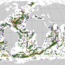
            Seamounts are 'undersea mountains' that are hotspots of diversity and areas of conservation importance. We still don't have a comprehensive inventory of seamounts. However, we can estimate the location and number of seamounts by examining global bathymetry (depth of seabed) grids.  As maps of the seabed are improved, thanks to expansion of accoustic mapping, it is important that predictions of seamounts are kept up to date. We note that care must be taken when interpretting these data, as the seamount predictions are only as good as the quality of the underlying bathymetry. This study revises a previous estimate of seamounts, increasing the total to 37,889.  The GIS dataset of seamount predictions is available here (https://doi.org/10.1594/PANGAEA.921688).

            Abstract

            Seamounts are important marine habitats that are hotpots of species diversity. Relatively shallow peaks, increasedproductivity and offshore locations make seamounts vulnerable to human impact and difficult to protect. Present estimates ofseamount numbers vary from barely 10000 to more than 60000), because locating and identifying them remotely can bedifficult. Seamount locations can be estimated by extracting conical shaped features from bathymetry grids. These predictedseamounts are a useful reference for marine researchers and can help direct exploratory surveys. However, these predictionsare dependent on the quality of the surveys underpinning the bathymetry. Historically, quality has been patchy, but isimproving as mapping efforts step up towards the target of complete seabed coverage by 2030.This study presents an update of seamount predictions based on the most recent SRTM30 global bathymetry. This updatewas prompted by a seamount survey in the British Indian Ocean Territory, where locations of two putative seamounts, basedon several previous global seamount predictions, were visited, but no such features were detected during echosoundersurveys. An examination of Admiralty charts for the area showed that the summits of these putative features had soundingsreporting no bottom detected at this depth where this depth was similar to the seabed reported from the bathymetrygrids: we suspect that these features likely resulted from an initial misreading of the charts. We show that perhaps 15phantom seamount features, derived from a misinterpretation of no-bottom sounding data, persist in current globalbathymetry grids and updated seamount predictions. Overall, we predict 37,889 seamounts, an increase of 4,437 from theprevious prediction derived from an older global bathymetry grid. This increase is due to greater detail in newer bathymetrygrids as acoustic mapping of the seabed expands

            Content

            Author and article information

            Journal
            UCL Open: Environment Preprint
            UCL Press
            22 June 2020
            Affiliations
            [1 ] Zoological Society of London & University College London
            [2 ] Zoological Society of London
            [3 ] University of Plymouth
            [4 ] University of St Andrews
            Author information
            https://orcid.org/0000-0002-6731-4229
            https://orcid.org/0000-0003-4011-0207
            https://orcid.org/0000-0003-3108-9231
            https://orcid.org/0000-0002-4415-7152
            https://orcid.org/0000-0002-6438-6892
            https://orcid.org/0000-0002-8647-5562
            Article
            10.14324/111.444/000044.v1
            187d3cee-72fd-4f6b-a34e-0736560dedc4

            This is an open access article distributed under the terms of the Creative Commons Attribution License (CC BY) 4.0 https://creativecommons.org/licenses/by/4.0/, which permits unrestricted use, distribution and reproduction in any medium, provided the original author and source are credited.

            History
            : 22 June 2020

            All data generated or analysed during this study are included in this published article (and its supplementary information files).
            Geography
            Environmental science,Bathymetry,Seamounts,Knolls

            Comments

            Decision Date: 22/06/2020

            Handling Editor: Dan Osborn

            This article is a preprint article and has not been peer-reviewed. It is under consideration following submission to UCL Open: Environment Preprint for open peer review.

            2020-09-17 13:10 UTC
            +1

            Data in the form of a shapefile of seamount predictions will soon be available at (https://doi.pangaea.de/10.1594/PANGAEA.921688)


            2020-09-04 13:28 UTC
            +1

            Comment on this article